Select the desired ride tab below then click or tap on the individual route links if available to access your desired route or the Combined Routes page. Helmets are required on all club rides. When joining us the first time, please bring a signed waiver to the start; download it here.
NOTE: The first tab is not an upcoming ride. It is a retrospective on some of our past rides to hopefully pique your interest. The rest are upcoming rides.
Guidelines to using maps and profiles: Learn more…
To play the video, hit the arrow in the center of the frame.
Select a past ride from below to view it. Then hit the replay arrow in the center of the video frame.
August 18, 2024: Phil's Ride: Whale of a Century
August 11, 2024: Phil's Ride: The Orange Coast Tour
June 30, 2024: Jacques' Ride: Corner - Will Rogers to Mount Holyoke
March 20, 2022 Phil's Ride: Oak Ridge Rides
December 12, 2021: Phil's Ride - Foothill Footsie Century
November 28, 2021: Phil's Ride - Cal Poly By Golly
September 19, 2021: Phil's Ride - Wandering To Whittier
September 12, 2021: Phil's Ride - The Grand Tour Lite
April 18, 2021: Phil's Ride - Laguna Canyon Century
August 15, 2021: Phil's Ride - Huntington Beach Go Around
April 11, 2021: Phil's Ride - Winding Roads of Orange County

Every Thursday, 8:30 a.m. (unless otherwise specified).
Start Location: Ballona Creek Bridge. From I405 exit Culver Blvd and head West or take Rte 90 West and take Culver Blvd exit turn left. Right on Esplanade St, left on Convoy St, and right on Pacific Avenue. Park by the Lagoon on the right. The bridge is about 2 blocks North on Pacific.
For a map and directions to the start, click Start.
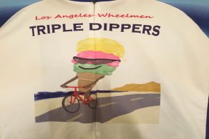
Riders usually goes South to Palos Verdes on the bike path and then do some riding on the Peninsula. There are optional climbs including the 3 “dips” which give the ride its name. The group usually stops for a break at the Golden Cove shopping area. Occasionally the group will decide to vary the route and explore specific sites elsewhere in the city. A typical day is 40 - 50 miles but often individual riders either cut the day short or add extra miles as desired. Contact Lewis Singer lewissinger@nullgmail.com for details.
Check out our weekly newsletter here to get a preview of some of our past rides...Newsletter (http://www.lawheelmen.org/vp-newsletter)
We hope to see you there!

Sunday, July 20 – 8:00 a.m. (full century) & 9:00 a.m. (metric and half)
Start Location: (Full Century): VALLE LINDO PARK IN CAMARILLO. Take the 101Frwy North to Camarillo and exit north on Carmen Dr. Left on Ponderosa Dr & Right on Valle Lindo Dr to park. Park where Valle Lindo Dr curves left.
For a map and directions, click Start.
Start Location: (Metric & Half Century): PARKING LOT NEAR MISSION PARK IN VENTURA Take 101 Frwy to Ventura and exit at California St. Go 1 block north to a left on Santa Clara St. Go 4 blocks west to parking lot on the right opposite Junipero St.
For a map and directions, click Start.
Routes:
- Full Century – 104 miles – 2400 feet of elevation gain (barometric)
- Metric Century – 64 miles – 2000 feet of elevation gain (barometric)
- Half Century – 55 miles – 1600 feet of elevation gain (mapping software)
- Combined Routes
When we first began running this ride back in 2015, for some reason we always rode it in the spring. Perhaps we thought that since it was a fairly easy century we should run it while the days were still short. But then a couple of years ago I realized it was the perfect summer century since it spends most of the day on the coast. Since we hardly have enough coastal rides to get us through the summer, it has now become one of our annual summer rides. It’s a great ride taking you up to Santa Barbara where I don’t think any of our other regular rides go. Reason enough to ride with us today. There is very little climbing and there are long stretches without a single stop sign. All that makes for a pleasant and easy ride. The ride gets its name from the large whale skeleton on view at the Sana Barbara Museum of Natural History. Both the full and metric century take you to view this. You also get to see the Santa Barbara Mission. The full century route runs from Camarillo up to Santa Barbara and back so, yes, there are a few non-coastal miles at the start and at the end. The metric and half centuries start in Ventura and ride the center portion of the full century. This gives you the best portion of the full century and with the later start time, a chance to still ride with the full century riders. Starting in Ventura, they join the full century route up to Santa Barbara and back to Ventura. The only difference between the two is the half century skips the trip up to the whale in Santa Barbara (sorry – no whale for you). There is a treat for Habit fans. Although we have shifted the lunch location on many of our routes to the Habit, today you get to visit one of the earliest Habit locations. The Habit got its start in Santa Barbara although I think our lunch location today is not the original Habit. NOTE there are two separate start locations and start times.

Sunday, July 27th – 8:30 a.m.
Start Location: EL DORADO PARK in Long Beach. From San Diego Frwy (405), off & North/East on Studebaker 1 mi. to Park. Park in Library lot on right just before Spring St.
For a map and directions, click Start.
Routes:
- Long – 64 miles – 1200 feet of elevation gain (barometric)
- Medium – 45 miles – 500 feet of elevation gain (barometric)
- Short – 31 miles – 500 feet of elevation gain (mapping software)
- Combined Routes
With a name like “Long Beach Rides” you would expect this to be a coastal ride but today you will spend relatively little time actually at the coast. However, you do spend much of the day riding in and around Long Beach, so you never really get too far from the coast and there are no major hills in Long Beach to prevent the cooling ocean breezes from reaching most of the city. Each route does start with a short run inland with the long actually going as far in as La Mirada. But these little forays away from the coast come early in the ride and even if you ride the long route, you should be returning back towards Long Beach by about 10 a.m. before the day has had a chance to really warm up. Once we get back to the Seal Beach and Long Beach area all routes seemingly wander aimlessly around the area finally stopping for lunch. Long Beach is a notoriously bike-friendly city. You will see numbered bike route signs all over which, frankly, I have never been able to make sense of. Nonetheless, it makes for pleasant riding. These are among the flattest routes we have in the club library with only the long doing any significant climbing and even it never gets much over 200 feet above sea level. Although the routes don’t spend much time with each other, they do come together for lunch, if the riders can manage to get there at the same time. Well, that’s not very likely, but it would be nice if it happened. Flat and close to the coast – these should be the perfect routes for July.
For possible announcements such as road closures, weather conditions or any other related comments, look for the matching event by ride name on our Facebook pages using the links below.
 Los Angeles Wheelmen Bicycle Club
 Los Angeles Wheelmen Bicycle Club Grand Tour

