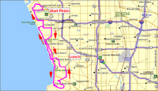
New Maps and Profiles
The route maps and elevation profiles displayed on this site are all new and have increased functionality. Here is a list of the features of these new maps and profiles:
1. The maps are now Google Maps and have all the functionality of a Google map
You can zoom in and out to see details of the route
You can pan the map right, left, up down
You can switch to satellite view to see actual terrain, structures, etc.
You can go to street view — for instance to see what the start location or lunch looks like
2. The profile is tied to the map. You move your cursor along the profile and it shows you where you are on the map or you put your cursor over a portion of the route and it shows you where you are on the profile.
3. If you click in the upper left corner of the map where it says “view full route”, it will take you to the web site where the maps are created and you will see a larger version of the map along with the route directions generated. At that site you will have additional options.
If you select the “export” tab on the right, there is an export option for Google Earth. If you have Google Earth installed (it’s free from Google), it can open Google Earth and load the route in. At that point you can do anything Google Earth allows you to do, but the most interesting thing is to “fly” through the route.
There are also export options that allow you to download the route directly into a Garmin GPS device.
There are also print options for printing the map and the generated route directions.
We think these new maps will provide much more detail and information about the week’s upcoming routes.
Although the system used to create these maps also creates a route sheet, which you can download if you wish, we think our traditional route sheets are a bit better and we will continue to offer them on this site. However, if you download the route into your GPS device (Garmin), the route directions displayed on the Garmin will be those of the system generated route. Typically, this will include “extra” instructions, such as when a street changes names or sometimes when the street simply makes a bend to the right or left without really changing names.